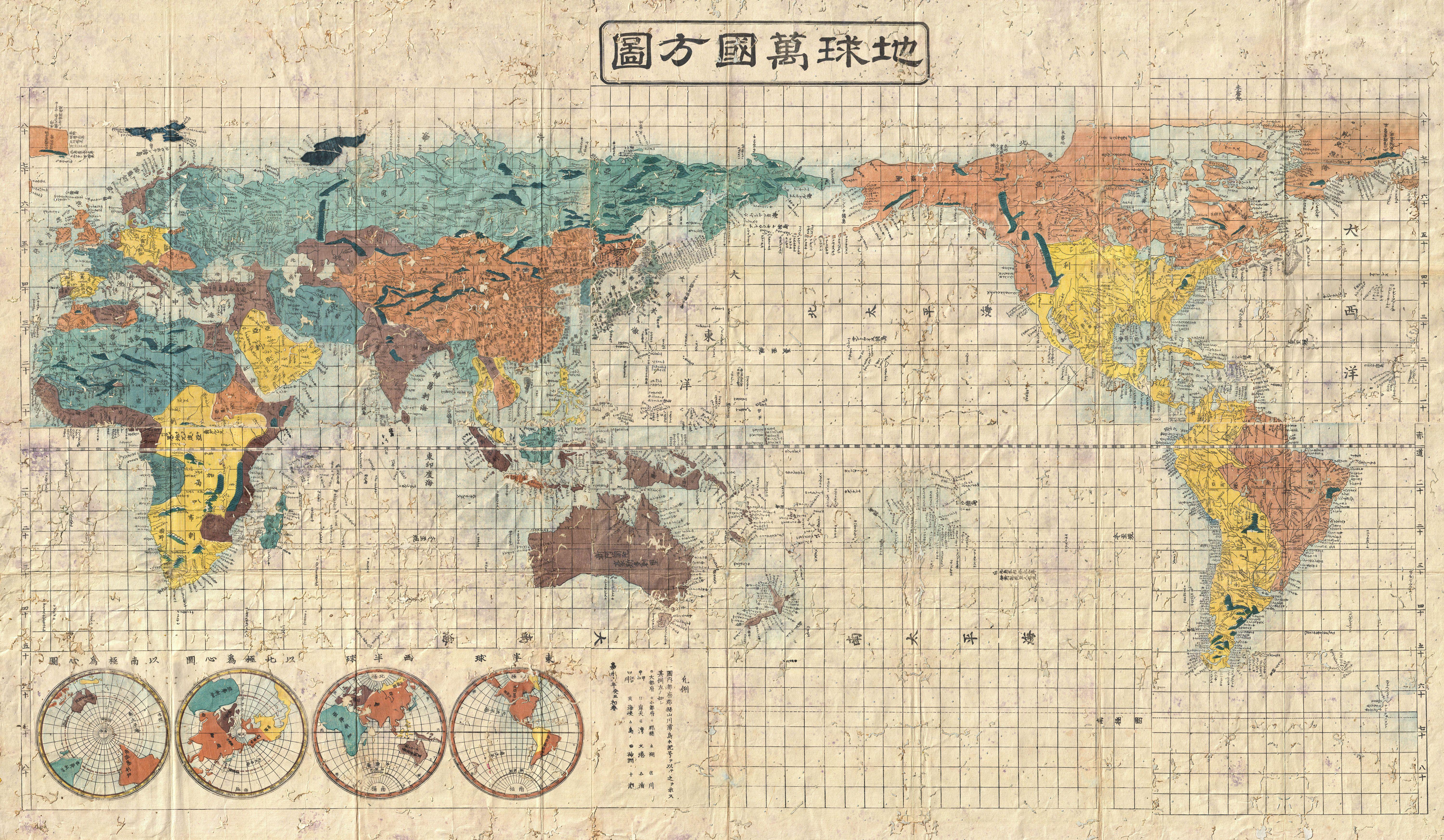
It is well known that the atlas made in Japan and the atlases made abroad, let’s say in London, have different compositions. That is, Japan is placed at the center in the former, and England in the latter. As a result, the Pacific Ocean spreads vastly, with North and South America placed on the right side and Africa on the left in the former atlas, while South America and Africa face one another closely across the Atlantic Ocean in the latter atlas. Of course the Pacific Ocean gets divided in half, and if you look for Japan, it barely retains its trace, like a stretched scar at the top corner on the right.
As I write this, it may appear commonsensical and hence not move you at all, but, by way of experiment, I suggest actually buying two maps and place them on both sides of the wall for comparison. When placed between two maps, we would actually feel the transformation of our own worldview. In my case, when a printing gets shifted slightly, things whose existence I took for granted are transformed into a source of tremendous shock that even causes a sensation of nausea.
(Matsuda Masao)